PJT-276 Paul Taylor
Community Mural Print- "Pilot Hill Rainbow"
Community Mural Print- "Pilot Hill Rainbow"
Couldn't load pickup availability
Community Mural Print- "Pilot Hill Rainbow"
Paul Taylor: Artistic Director
Artists: Community
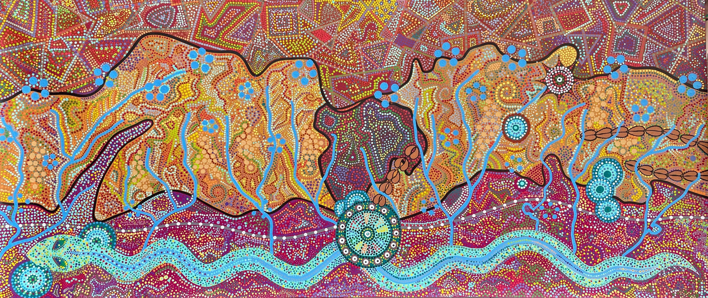
Print of the May 2021 Pilot Hill Rainbow Community Mural
Pilot Hill Rainbow, Laramie High School Mural Project, design by Madie Sprinkle with Justin Deegan, Rebecca Watson, Erin Klauk. Dots were painted by 300 Laramie High S Art and Geology students. Science Consultant: Chris Moody. Artistic Director: Paul Taylor.
Original mural measures 10' x 52"
Pilot Hill Rainbow Story
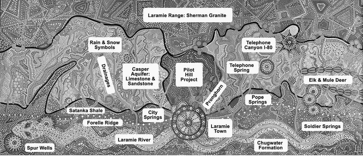
This mural is a symbolic topographical map of our Albany County region telling our unique “water story”.
Looking east from Laramie (large central blue circle) towards the Laramie Range (top Red section), we celebrate our Pilot Hill Recreation Area, a regional treasure shown in the central dark Brown/Purple area. This 7,000 acres sits on and protects 13% of our precious Casper Aquifer recharge zone represented in the center Gold section. This is the slope of the Laramie Range as you look East. Rain & snowfall (Blue dot circles) collects and seeps underground through the Blue Drainages, flowing downhill in the dark, it emerges in our numerous springs and wells, the smaller Blue circles. From L to R we have the 2 Spur wells, 2 Turner wells of the City Springs area, historic Telephone Springs, Pope Springs, and Soldier Springs. These Casper Aquifer fed springs and wells gift our community with 50% of our water. The other 50% of our water comes from the Laramie River represented here by the symbolic Rainbow Serpent who brought water to the world in Aboriginal Creation.
Our mural maps 3 geological regions; the crystalline Sherman Granite of the Laramie Range in the top Red section; the limestone and sandstone “sponge” section of the western slope in the central Gold section; the Satanka Shale and Chugwater Formation region upon which our town sits and the Laramie River flows, in the bottom Magenta section. Also note the Forelle Limstone Ridge (Grey line & White dots) which borders our LHS and upon which our City Water Tanks sit; and note the pronghorn, mule deer and elk that migrate through the region.
Our mural is inspired by geography, geology and Aboriginal art and culture of “Caring for Country.”
Ridge (Grey line & White dots) which borders our LHS and upon which our City Water Tanks sit. Tracks denote the pronghorn, mule deer and elk that migrate through the region. Our mural is inspired by geography, geology and Aboriginal art and culture of “Caring for Country.”
Variations of the print:
Framed print 27" Long x 12" High x 1" Deep. Framed in slim black metal frame with white matting and D-ring and wire for hanging
Framed print 18" Long x 9" High x 1" Deep. Framed in a slim black plastic frame with white matting and D-ring and wire for hanging
Blank Greeting Card 8" Long x 4" high blank greeting card. Envelope included. Can also be framed
Share